
The Fox River through St. Charles is best understood as two separate bodies of water joined by the downtown dam.
The larger upper pool begins below the South Elgin dam and continues south to downtown St. Charles. It contains the water around Jon J. Duerr Forest Preserve, Blackhawk Bend, Red Gate Bridge, Ferson Creek, Boy Scout Island, Pottawatomie Park, and the approach to the St. Charles dam. The lower pool begins below that dam and runs through southern St. Charles to the Geneva dam.
Municipal boundaries matter when choosing a park or launch. The dams matter more once the kayak is on the water. Each creates a firm end to a trip and gives the water upstream a different character from the river below it.
The upper pool contains islands, shallow bends, bridge current, residential docks, natural banks, summer vegetation, mud flats, riprap, and a developed downtown riverfront. The lower pool is shorter and more urban, with a convenient carry-in at Mt. St. Mary Park, public shoreline access farther south, and a practical takeout near downtown Geneva.
Neither pool is especially large by bass-boat standards. A day here bears little resemblance to running between distant creek arms on Table Rock Lake or searching miles of offshore structure on a large reservoir. The Fox through St. Charles rewards a more deliberate pace. A kayak angler can choose one section, fish it carefully, and return to the same launch without turning the trip into an endurance exercise.
That smaller scale is part of the appeal. The river remains varied enough to stay interesting, but compact enough to learn.
Read the River by Pools
The South Elgin, St. Charles, and Geneva dams divide this part of the Fox into a sequence of impoundments. The official Fabulous Fox Water Trail places the South Elgin dam at river mile 67.54 and the Geneva dam at river mile 57.9. Between them, public access sites are spaced closely enough to support short out-and-back trips, one-way paddles, and shore-based visits.
An impounded Fox River pool does not behave exactly like a lake. Water continues moving downstream, particularly after rain and through constrictions. It also does not behave like a continuously free-flowing smallmouth stream. Much of the channel can become broad, shallow, and slow, while meaningful current concentrates around bridges, islands, tributaries, shallow bends, and the remnants of the main channel.
The distinction becomes visible over the course of a trip. At one location, the kayak may drift steadily along a rocky bank. A short distance away, wind may exert more influence than current. A bridge opening can then compress the flow into a narrow lane before the river spreads again into quiet water.
Those localized changes define the practical sections of each pool.
The Upper Pool: South Elgin Dam to St. Charles Dam
The upper pool is the larger and more varied of the two. The official water trail measures 4.43 river miles from Jon J. Duerr Forest Preserve to Ferson Creek Park, followed by another half-mile from Ferson to Boy Scout Island. The river continues beyond Boy Scout Island through the southern portion of the pool and into downtown St. Charles.
For fishing and trip planning, the upper pool can be divided into six useful sections: the upper reach below South Elgin and around Jon Duerr, the island water and Blackhawk Bend, Red Gate Bridge and Norton Creek, Ferson Creek and the central pool, Boy Scout Island and the southern vegetation, and the developed approach to downtown St. Charles.
Each section presents a different balance of current, depth, cover, access, and recreational traffic.
The Upper Reach and Jon J. Duerr Forest Preserve
Jon J. Duerr Forest Preserve is the northernmost practical access point for the pool covered by this guide. It sits on the west bank near river mile 65.44 and provides free carry-in access, parking, restrooms, drinking water, shelters, fishing access, and connections to regional trails. At the time of writing, the canoe and kayak launch remains open while the motorized trailer launch is closed for improvement work.
The water immediately downstream begins with a more natural character than the developed sections near downtown St. Charles. The official water-trail itinerary notes a group of five islands south of the launch, followed by a sharp bend and additional islands before the river continues toward St. Charles.
This upper reach requires more navigation than the broad water near Ferson. Islands divide the flow, shallow bars narrow the usable channels, and the main path is not always the most visually obvious one. During lower water, current may concentrate through one side of an island while another channel becomes too shallow for comfortable travel. After rain, those same channels can carry substantially more water and create stronger seams behind the island tips.
The islands also break a long river into smaller pieces. Each upstream point divides the current. Each downstream end creates a convergence, seam, or eddy. Open water between islands may offer little distinctive structure, while the ends and narrow side channels provide a clearer reason for fish to occupy one location.
Jon Duerr is well suited to a one-way trip ending at Ferson Creek Park, provided transportation is arranged at both ends. It is also a practical place to explore the upper end of the pool without committing to the more developed water downstream. The official route to Ferson is considered a novice segment under normal conditions and contains no portage, although river level and recent rainfall still determine whether that description fits a particular day.
The Island Water and Blackhawk Bend
As the river moves south, the island channels gradually give way to a broad bend with shallower water, more visible vegetation, and sections where the bottom rises close enough to interrupt a trolling motor. This is the portion I think of as Blackhawk Bend, and it marks a practical transition between the island water above and the more developed Red Gate and Ferson sections below.
The bend can carry more noticeable current than the central pool, especially where the river narrows or swings around shallow ground. Grass flats and seasonal lily pads line parts of the edges, while the surrounding banks remain relatively natural compared with the docks and residential development farther south.
Blackhawk can fish well, but it also establishes the practical northern limit of many Ferson-based out-and-back trips. Reaching it is easy enough with a motorized fishing kayak under favorable conditions. Fishing the water carefully and returning against wind or current consumes more time and battery than the distance alone suggests.
Low water makes the section feel smaller. Shallow vegetation becomes more pronounced, bars begin to divide the usable path, and route selection can demand more attention than the fishing. Moderate flow restores definition to the channel and strengthens the current around island ends and the bend itself.
For a first trip launched from Ferson, Blackhawk is better treated as the destination than as the beginning of another section. There is already enough water between the bend and the launch to fill a half day.
Red Gate Bridge and Norton Creek
Red Gate Bridge is the clearest hydraulic feature in the upper half of the pool. The bridge divides the river through several openings. The central passage generally carries deeper water and more recreational traffic, while the western opening can develop a faster lane across rock and rubble. Downstream of the pylons, the divided current forms seams, wakes, slower pockets, and localized scour.
My most reliable smallmouth fishing in this section has come near the western pylon gap with a Ned rig. The productive water has usually been the edge of the localized current rather than the fastest portion of the opening. The downstream wake also attracts other river species, including catfish, particularly where the divided flow curls into a slower pocket.
The bridge is worth fishing as a collection of separate positions. The upstream face, both sides of each pylon, the downstream wake, the outside seams, and the deeper base can all behave differently. Boat traffic through the central opening also makes it important to remain visible and avoid holding in the navigation lane.
Norton Creek enters from the eastern side near the bridge. The creek itself can become extremely shallow, and its mouth should not be assumed to provide enough depth for a kayak at every river level. The grass edge south of the easternmost pylon has produced largemouth on a topwater popper, particularly where the vegetation creates a narrow boundary between open river and protected water.
That combination captures the character of Red Gate. Smallmouth relate to rock, current, and bridge structure, while largemouth are more likely to appear along grass and quieter edges. The same three-rod river system can handle both without treating them as separate trips.
Red Gate is also a practical destination from Ferson. It offers enough distinct water to fish carefully without requiring the longer run to Blackhawk Bend.
Ferson Creek and the Central Pool
Ferson Creek Park is the most convenient access point for the middle of the upper pool. The free west-bank carry-in includes parking, a paddlesports launch, boat racks, picnic facilities, fishing access, and restrooms and water during normal park operations. The park is open from dawn to dusk.
This is the launch I use most often because it allows several different trips from the same starting point. Heading north leads toward docks, natural shoreline, Red Gate Bridge, Blackhawk Bend, and eventually the island water below Jon Duerr. Heading south reaches golf-course riprap, residential cover, Boy Scout Island, developed vegetation, the railroad bridge, and downtown St. Charles.
The river immediately around the launch is broad and usually lacks the concentrated current found at Red Gate or Blackhawk. That makes Ferson a useful base but not necessarily the most distinctive fishing water in the pool. Its real value is location.
North of the launch, docks begin along the western bank while the opposite shoreline remains more natural. Farther upstream, development appears on both sides. Docks provide shade, posts, cross-members, and small current breaks, but their value changes with depth. A dock over several feet of water offers a more complete position than one standing over a nearly exposed mud flat.
Ferson Creek enters beside the park, although the adjoining Ferson Creek Fen Nature Preserve has specific protections, including a prohibition on shoreline fishing within the preserve. The public park launch should not be treated as permission to fish every nearby bank.
South of the launch, the two banks separate into different kinds of water. The eastern side includes golf-course riprap and docks. The western side becomes shallower and muddier, with broad areas that may offer little depth several yards from shore. During low summer conditions, carp are often visible rooting through this mud even when bass activity is difficult to detect.
The east-bank rock provides a more defined edge. Swimbaits have been most useful where gravel or broken rock continues into adequate depth rather than ending in only a foot of water. The bank can look uniform from a distance, but the productive areas usually contain an additional change: a dock, a depth transition, a patch of larger rock, or a slight increase in current.
Ferson works especially well for an angler who has not decided on a direction before launching. The river can be inspected from the water, then the day can be committed north or south according to wind, traffic, vegetation, and clarity.
Boy Scout Island, Vegetation, and the Railroad Bridge
Boy Scout Island sits about half a river mile downstream from Ferson, although it serves a different access need. It has a developed concrete ramp, a nearby sandy shoreline usable by paddlers, parking, fishing access, seasonal restrooms, and space for motorized boats. The park charges daily parking during the main summer season and closes after the first winter snowfall, usually reopening in March or April when conditions allow.
The official water trail specifically notes motorized boat traffic between Ferson and Boy Scout Island. That traffic extends beyond the half-mile route, particularly during warm weekends and around downtown St. Charles.
Boy Scout Island is the better choice when a developed ramp is needed or when launching a larger craft. For a fishing kayak that can be carried, Ferson is usually simpler and avoids the seasonal parking fee.
The water south of Boy Scout Island changes substantially during summer. A large lily-pad field develops across shallow water, with grass and open holes creating a patchwork rather than a continuous mat. The exact boundaries change from year to year and with river level. A field that can be crossed easily by a hollow-body frog in one season may become sparse, buried, or inaccessible in another.
This vegetation creates one of the clearest reasons to carry the optional heavy rod. On many trips, the medium-heavy casting rod provides enough power for the edges and open holes. Once the pads become dense enough that a fish must be moved through stems, the heavy setup with braid earns its place.
The pad field also affects travel. A kayak can work along the edge or enter openings unavailable to conventional boats, but shallow mud beneath the vegetation can make paddling or motoring inefficient. Route planning becomes part of fishing the section.
The railroad bridge south of the vegetation restores harder structure and more localized current. Its pylons create the same general hydraulic features found at Red Gate, although each bridge has its own depth, alignment, and flow distribution.
One of my few smallmouth from the southern route came from the downstream side of a railroad-bridge pylon near the edge of the localized current. The fish followed a Ned rig upward and struck near the surface as I retrieved it for another cast. The strike occurred high in the water column, but the pylon and its current break had established the fish’s original position.
Pottawatomie Park and the Downtown Approach
The upper pool becomes increasingly developed as it enters downtown St. Charles. Pottawatomie Park occupies the east bank and offers fishing, extensive park amenities, access to the Fox River Trail, paddlewheel riverboats, and an accessible seasonal dock. Boy Scout Island lies directly across the river, making this one of the busiest recreational areas in the pool.
Summer traffic can include motorboats, personal watercraft, paddlers, and the excursion boats operating from Pottawatomie. The setting is attractive and accessible, although anglers looking for quiet water will generally do better early in the day or outside the busiest summer periods.
Farther downstream, the Frank Gorham Memorial Canoe Launch provides a free seasonal carry-in on the east bank near downtown. It has designated parking, fishing and trail access, and a seasonal dock, but fewer amenities than the larger parks nearby.
The St. Charles dam ends the upper pool. It should be treated as a hard boundary rather than another piece of fishable structure to approach from a kayak. Low-head dams can create recirculating currents that are difficult to recognize from upstream, and the Illinois Department of Natural Resources maintains separate dam-safety and river-closure information for public use.
The closer a trip moves toward downtown, the more attention should shift from finding another bank to preserving a wide safety margin above the dam.
The Lower Pool: St. Charles Dam to Geneva Dam
The lower pool begins below the St. Charles dam and continues through southern St. Charles into downtown Geneva. Its most practical public route runs from Mt. St. Mary Park to the Geneva Boat Launch, a water-trail segment of about 1.23 miles.
This pool is shorter and more urban than the water north of Ferson. It can be divided into three useful areas: the St. Charles tailwater and Mt. St. Mary Park, southern St. Charles and Five Islands Park, and the Geneva reach above the Geneva dam.
My detailed fishing experience is concentrated in the upper pool, so the lower section is described more conservatively. Its access, boundaries, and public amenities are well documented. Its smaller holding water deserves the same direct observation over time before being described with equal specificity.
Mt. St. Mary Park and the St. Charles Tailwater
Mt. St. Mary Park is the primary carry-in access below the St. Charles dam. The west-bank park provides free paddlesports access, parking, restrooms, drinking water, fishing access, shelters, trails, and a broad range of public amenities. The carry from the parking area is longer than at Ferson Creek, which matters when moving a fully rigged fishing kayak.
I have kayaked this section of the lower pool from Mt. St. Mary Park and have also wet-waded the river from the park upstream toward the dam. Under suitable conditions, much of that reach can be covered on foot, although depth, current, bottom stability, and dam discharge should be evaluated each time rather than assumed from a previous trip.
The section is also commonly used by bank anglers. People fish from both sides of the river and sometimes enter the water to reach seams, isolated rocks, bridge structure, or deeper lanes that cannot be reached comfortably from shore. The combination of public parks, trail access, shallow water, and the downtown setting makes this one of the more accessible fishing areas in St. Charles.
The immediate tailwater below the St. Charles dam can be reached from the eastern side near the municipal buildings. Concrete stairs descend toward the river below the low-head dam and provide practical access for anglers on foot. On a typical weekend, there are often one or two people working the water where the overflow drops into the river.
The splashdown attracts attention for an obvious reason. Water passing over the dam creates oxygenated, turbulent flow and a distinct transition into the slower river below. The most visible target is the base of the dam, although the useful water extends beyond the white water. Fish may hold along the softer outside edges, behind exposed rock, in depressions below the turbulence, or where the main outflow begins to spread across the channel.
The road-bridge pylons immediately downstream deserve equal attention. It is easy to face the dam for an entire session because the falling water dominates the view. Turning downstream reveals another set of current breaks. The pylons divide the outgoing flow, create protected wakes, and form seams where faster tailwater meets slower water.
I have wet-waded the full distance between Mt. St. Mary Park and the dam, fishing both the broad river and the more concentrated water near the upper end. This section offers a useful contrast to the impounded water above downtown. The current is more apparent, the bottom can be read directly underfoot, and the relationship between dam outflow, bridge pylons, shoreline edges, and the remaining channel is easier to see.
The accessibility of the area should not obscure the hazards associated with a low-head dam. Water conditions can change substantially with discharge, and the recirculating hydraulic immediately below a dam can be dangerous even when the surrounding river appears manageable. Wading should remain well outside that hydraulic, with conservative judgment applied to current speed, footing, depth, and the ability to return to shore.
Southern St. Charles and Five Islands Park
Five Islands Park provides public shoreline access farther south in St. Charles. The park is undeveloped, open from dawn to dusk, and offers street parking, fishing, and river access. It is not listed as a designated paddlesports launch, so it should be treated primarily as shoreline access rather than a substitute for Mt. St. Mary.
The name can cause confusion because the upper pool also contains a group of islands below Jon Duerr. Five Islands Park is a separate location in southern St. Charles.
This part of the lower pool is useful for anglers who want to explore the river without launching a kayak. The undeveloped character also means fewer facilities and less certainty about comfortable bank access at every water level. High water can cover usable shoreline, while summer vegetation may limit casting from land.
As elsewhere on the Fox, public access should be distinguished from visible shoreline. Residential banks, retaining walls, docks, and open-looking lots do not become public simply because they can be reached from the river or trail.
The Geneva Reach and Boat Launch
The river continues through an urban and suburban corridor toward Geneva. The Geneva Boat Launch sits on the west bank near Stevens Street at approximately river mile 58.29 and provides carry-in access with street and lot parking. The Fabulous Fox Water Trail currently lists a seasonal permit requirement and no on-site amenities. Because Geneva officials considered changes to that permit policy in late 2025, the current requirement should be confirmed with the city before planning a launch.
The Geneva dam lies a short distance downstream. Paddlers continuing south must portage on river left, exiting above the dam and re-entering below it near the Route 38 bridge. That portage belongs to the next river journey, which continues toward Fabyan Forest Preserve and Batavia.
For this guide, the Geneva dam marks the end of the lower St. Charles pool.
Access Points at a Glance
Public access along the St. Charles pools ranges from simple shoreline entry to developed launches for larger boats. Each access point serves a different part of the river and a different kind of trip.

Upper Pool
Jon J. Duerr Forest Preserve
Best for island water, upper-pool exploration, and a one-way paddle or fishing trip to Ferson Creek Park.
Access Details→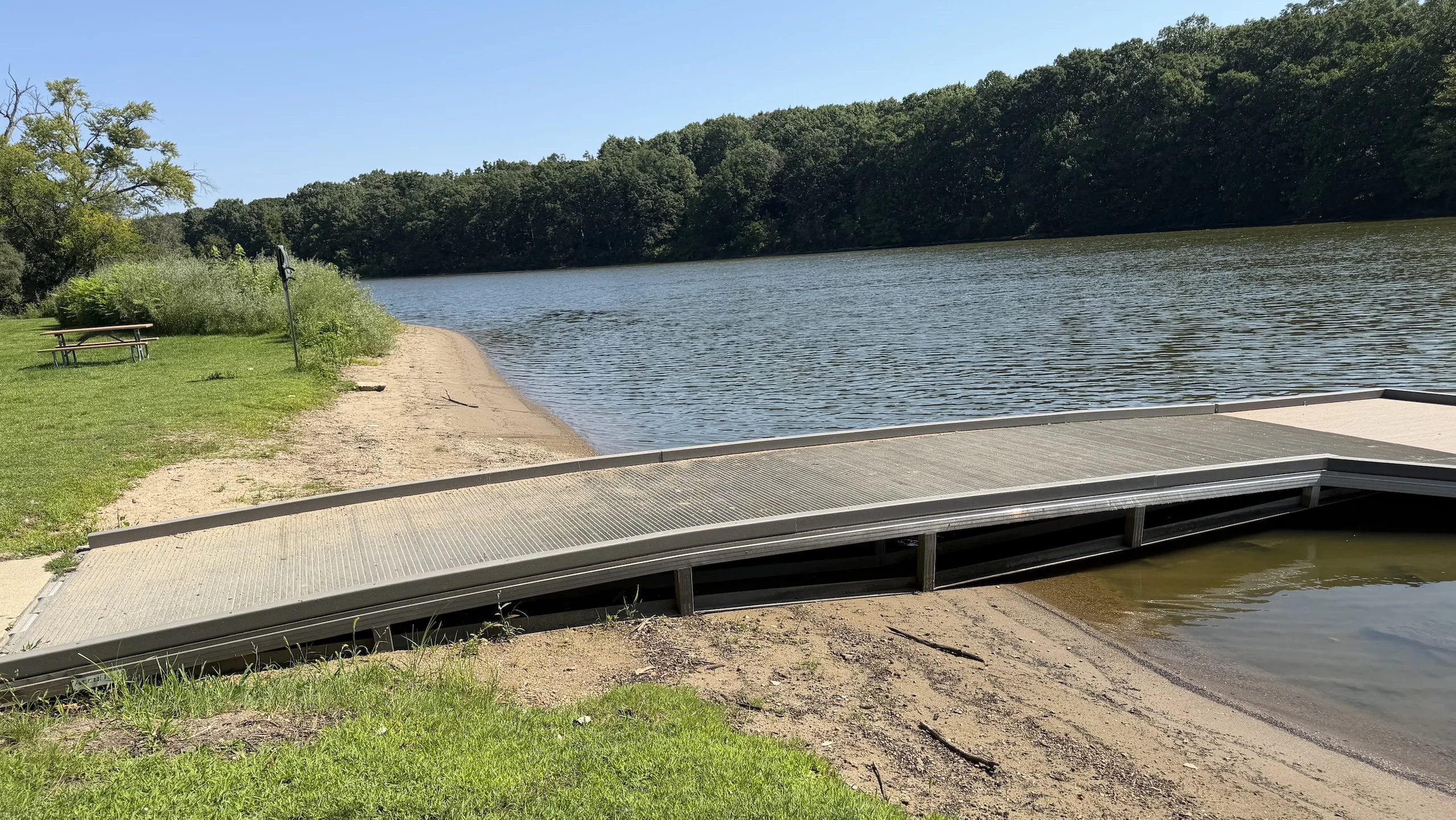
Upper Pool
Ferson Creek Park
Best for reaching the widest range of upper-pool fishing water from one convenient carry-in launch.
Access Details→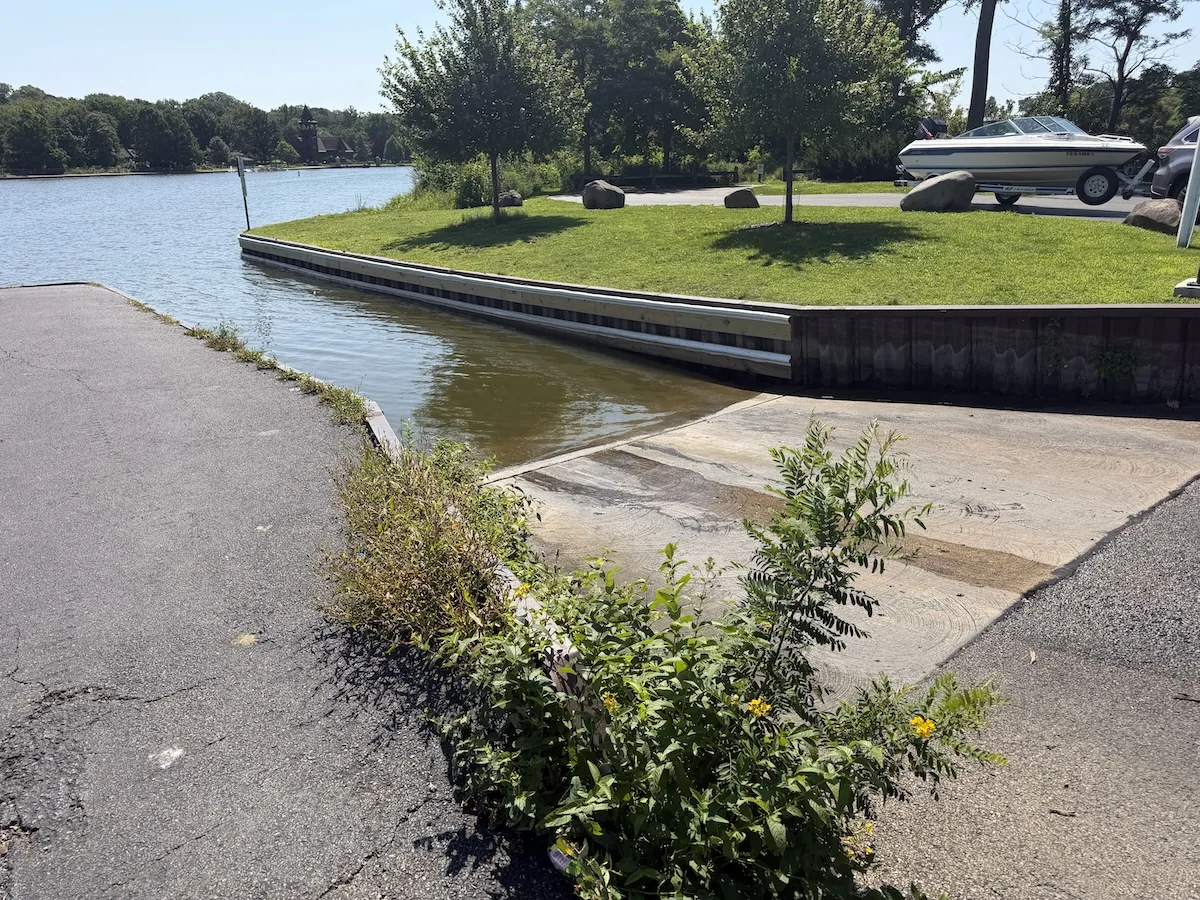
Upper Pool
Boy Scout Island
Best for developed-ramp access, motorized boats, and direct entry to the southern half of the upper pool.
Access Details→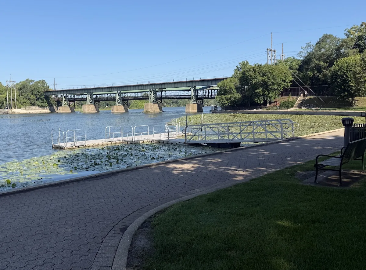
Upper Pool
Frank Gorham Canoe Launch
Best for a simple seasonal carry-in near downtown and access to the upper side of the St. Charles dam.
Access Details→
St. Charles
Pottawatomie Park
Best for downtown river access, shore fishing, family visits, and trips that benefit from extensive park amenities.
Access Details→
St. Charles
St. Charles Dam
Best for downtown river access, shore fishing, fishing the low had dam.
Access Details→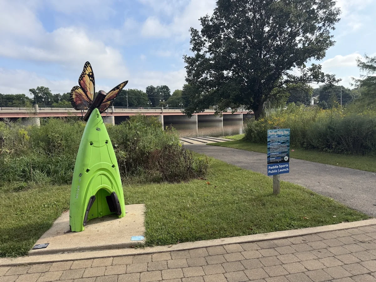
Lower Pool
Mt. St. Mary Park
Best for the lower St. Charles pool, access below the downtown dam, and short trips toward Geneva.
Access Details→
Lower Pool
Five Islands Park
Best for shore fishing and informal river access in southern St. Charles without launching a kayak.
Access Details→
Lower Pool
Geneva Boat Launch
Best for a lower-pool takeout or direct access to the water immediately above the Geneva dam.
Access Details→How the Seasons Change the River
The Fox should be read through recent conditions as much as through the calendar. The USGS station at South Elgin reports discharge and gauge height and provides historical daily statistics for comparison. It is the most useful public reference for understanding how much water is entering this part of the river, although a single gauge cannot describe the current, wind, vegetation, and depth inside every pool.
A familiar gauge reading becomes meaningful only after it has been paired with time on the water. The number can suggest whether the river is low, ordinary, rising, or unusually strong. The launch still reveals the local reality.
Late Winter and Early Spring
The river begins the year cold, visually open, and largely free of developed vegetation. Docks and seasonal facilities may still be absent, Boy Scout Island may remain closed, and ice can persist in sheltered parts of the pools.
Rain and snowmelt can produce rapid changes. Water that was slow and clear enough to fish comfortably may become high, dirty, and filled with floating debris after a single weather system. The most important decision during this period is often whether the river should be entered at all.
When conditions are manageable, the lack of vegetation exposes the underlying structure. Bridge pylons, rock banks, channel edges, laydowns, docks, and depth changes carry more of the visual burden. Cold water also reduces the value of covering long distances quickly. A smaller section fished carefully generally makes more sense than a long exploratory run.
Late Spring
Late spring begins to connect the pieces of the river. Water temperatures rise, seasonal docks and access facilities return, and shoreline vegetation begins to develop. Flow may remain elevated after rain, but the river usually offers more stable windows between events.
The first grass edges create defined boundaries in water that appeared featureless only a few weeks earlier. Pads emerge in southern shallows, although they have not yet formed the broad fields seen later in summer. Rock and bridge structure remain visible and important.
This is also when recreational use increases. Fishing kayaks, recreational paddlers, motorboats, and shore users begin sharing the same access points again.
Summer
Summer produces the strongest contrast between the upper and lower portions of the St. Charles pool. During dry periods, broad water near Ferson and downtown can become slow enough that wind influences the kayak as much as current. The remaining flow concentrates around Red Gate, Blackhawk Bend, island channels, bridge pylons, tributary mouths, and the deeper channel.
Vegetation becomes a major part of the southern route. Lily pads and grass create additional cover, divide open water into smaller lanes, and make some shallow areas difficult to cross. Open holes can remain easy to fish, while dense stems may justify replacing the standard medium spinning rod with the heavy casting setup.
Summer also brings the greatest motorized traffic. The developed ramp at Boy Scout Island and the paddlewheel boats at Pottawatomie make the central and downtown portions of the pool busier than the natural water above Red Gate. Early mornings generally provide a quieter river and easier positioning.
Low summer water exposes mud, reduces usable depth beneath some docks and laydowns, and can make tributary mouths nearly inaccessible. It also concentrates current into the remaining channel, giving greater importance to features that may appear ordinary during higher flow.
Fall
Fall gradually removes the cover that defined summer. Pads collapse, grass thins, and shorelines become easier to see and approach. Recreational traffic declines, particularly after warm-weather boating ends. Cooling water can make the river feel more open and manageable even before the leaves are gone.
Rain becomes important again. A dry fall can preserve low-water conditions well into the season, while a series of storms can restore current to island channels, strengthen bridge seams, and temporarily reconnect shallow cover.
Falling leaves create their own complication. Surface debris can interfere with some presentations and collect along the same seams that would otherwise be attractive places to fish. Boy Scout Island closes after the first snowfall, while other carry-in points may remain physically accessible until ice or local conditions intervene.
Winter
Winter turns the pools into a visual river corridor more often than a practical kayak fishery. Ice forms first in slow coves, shoreline pockets, and protected areas, while current zones may remain open longer. Seasonal docks are removed, ramps may close, and snow limits access even where the river remains partly open.
The Fox River Trail and riverside parks still provide ways to spend time along the water, observe exposed structure, and understand how channels and banks relate without the concealment of summer vegetation. Those observations can be useful when the river opens again.
Before Launching
The dams at South Elgin, St. Charles, and Geneva should be treated as fixed safety boundaries. Do not assume that calm-looking water above a low-head dam is safe to approach, and do not use historical familiarity as a substitute for checking current conditions.
The Illinois Department of Natural Resources maintains a statewide river-closure page and can restrict recreational boating on the Fox during dangerous flow. That status should be checked alongside the South Elgin gauge before leaving home.
A practical launch check should also include recent rainfall across the watershed, current discharge and whether it is rising or falling, wind direction and speed, air and water temperature, visibility and floating debris, seasonal access closures, expected motorized traffic near Boy Scout Island and downtown, and enough battery or paddling reserve to return against wind and current.
The Fox is familiar enough to encourage casual decisions. Its conditions can still change meaningfully between trips.
A River Small Enough to Learn
The Fox through St. Charles contains more variety than its size suggests. The upper pool moves from island channels and natural bends into bridge current, residential docks, broad shallow water, summer vegetation, and a developed downtown riverfront. The lower pool begins again below the St. Charles dam and carries a shorter, more urban river toward Geneva.
A visitor can experience it as a trail, a park system, a paddling route, or a place to fish from shore. A kayak adds the ability to connect those views and reach the water between public access points.
The river becomes more useful after its sections stop blending together. Jon Duerr is the entrance to island water. Blackhawk is the shallow upper bend. Red Gate concentrates current. Ferson provides the central base. Boy Scout Island begins the more developed southern water. The railroad bridge restores harder structure. Downtown ends the upper pool. Mt. St. Mary begins the next one.
Learning those sections takes time, though not necessarily long days. A few hours spent understanding one bridge, one bank, or one vegetation edge often adds more than racing from dam to dam.
That scale suits the river. There is enough water to keep exploring and little reason to hurry through it.